
As land becomes an increasingly limited resource, sustainable land management is no longer optional—it’s essential. Sustainable land mapping, powered by modern Geographic Information Systems (GIS), plays a crucial role in balancing development needs with environmental conservation and long-term land productivity. It enables planners, governments, and developers to make informed, responsible decisions based on accurate spatial data.
What Is Sustainable Land Mapping?
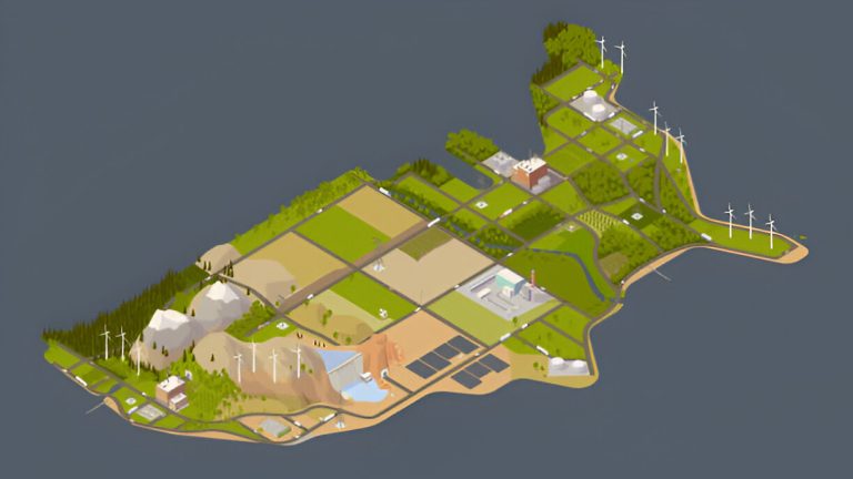
Sustainable land mapping involves using GIS technology to evaluate, plan, and manage land in ways that promote long-term environmental, social, and economic health. By visualizing land use patterns, terrain conditions, natural resources, and human impact, it supports smart planning that avoids degradation, waste, and conflict.
Goal: To optimize land use while minimizing environmental harm and ensuring equitable resource access for future generations.
Why It Matters
- Preserves Natural Resources
Helps identify forests, wetlands, and agricultural land that should be protected from urban sprawl or industrial activity. - Supports Smart Development
Guides infrastructure planning to avoid ecologically sensitive areas and reduce carbon footprints. - Mitigates Environmental Risks
Helps assess erosion-prone zones, floodplains, and deforestation patterns for proactive disaster risk reduction. - Promotes Equitable Land Use
Aids in allocating land fairly, reducing conflict over resources, and supporting inclusive urban and rural development.
Applications of Sustainable Land Mapping
- Urban and Regional Planning
Designing cities and towns with green spaces, efficient transport systems, and controlled expansion. - Agricultural Land Assessment
Identifying soil types, crop suitability zones, and water access to support food security and sustainable farming. - Environmental Impact Analysis
Assessing the consequences of proposed developments before implementation. - Land Tenure and Rights
Mapping indigenous and community lands to support fair land governance and reduce disputes.
Tools and Technologies Used
- GIS Software (ArcGIS, QGIS)
- Satellite Imagery and Remote Sensing
- Drone Mapping for Land Cover Monitoring
- Topographical and Cadastral Data Layers
- Geostatistical Analysis Models
These technologies allow for accurate and comprehensive understanding of land characteristics over time.
Challenges to Address
- Limited access to high-quality spatial data in some regions
- Need for cross-sector collaboration among planners, environmentalists, and government agencies
- Training and awareness gaps among local stakeholders
Conclusion
Sustainable land mapping is a vital tool for guiding development that is both productive and environmentally responsible. By leveraging GIS technologies, stakeholders across Kenya and beyond can achieve a more balanced approach to land use—preserving ecosystems while meeting the needs of growing populations.